User interface class for OpenLayers maps. More...
 Inheritance diagram for ilOpenLayersMapGUI:
 Collaboration diagram for ilOpenLayersMapGUI:
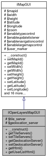
Public Member Functions | |
| __construct () | |
| getTileServers () | |
| Get HTML. More... | |
| setTileServers ($a_tile) | |
| getGeolocationServer () | |
| setGeolocationServer ($a_geolocation) | |
| getHtml () | |
| Get HTML. More... | |
| getUserListHtml () | |
| Get User List HTML (to be displayed besides the map) More... | |
| Public Member Functions inherited from ilMapGUI | |
| __construct () | |
| setMapId ($a_mapid) | |
| Set Map ID. More... | |
| getMapId () | |
| Get Map ID. More... | |
| setWidth ($a_width) | |
| Set Width. More... | |
| getWidth () | |
| Get Width. More... | |
| setHeight ($a_height) | |
| Set Height. More... | |
| getHeight () | |
| Get Height. More... | |
| setLatitude ($a_latitude) | |
| Set Latitude. More... | |
| getLatitude () | |
| Get Latitude. More... | |
| setLongitude ($a_longitude) | |
| Set Longitude. More... | |
| getLongitude () | |
| Get Longitude. More... | |
| setZoom ($a_zoom) | |
| Set Zoom. More... | |
| getZoom () | |
| Get Zoom. More... | |
| setEnableTypeControl ($a_enabletypecontrol) | |
| Set Use Map Type Control. More... | |
| getEnableTypeControl () | |
| Get Use Map Type Control. More... | |
| setEnableNavigationControl ($a_enablenavigationcontrol) | |
| Set Use Navigation Control. More... | |
| getEnableNavigationControl () | |
| Get Use Navigation Control. More... | |
| setEnableUpdateListener ($a_enableupdatelistener) | |
| Set Activate Update Listener. More... | |
| getEnableUpdateListener () | |
| Get Activate Update Listener. More... | |
| setEnableLargeMapControl ($a_largemapcontrol) | |
| Set Large Map Control. More... | |
| getEnableLargeMapControl () | |
| Get Large Map Control. More... | |
| setEnableCentralMarker ($a_centralmarker) | |
| Enable Central Marker. More... | |
| getEnableCentralMarker () | |
| Get Enable Central Marker. More... | |
| addUserMarker ($a_user_id) | |
| Add user marker. More... | |
| getHtml () | |
| Get HTML. More... | |
| getUserListHtml () | |
| Get User List HTML (to be displayed besides the map) More... | |
Protected Attributes | |
| $tile_server | |
| $geolocation_server | |
| Protected Attributes inherited from ilMapGUI | |
| $mapid | |
| $width = "500px" | |
| $height = "300px" | |
| $latitude | |
| $longitude | |
| $zoom | |
| $enabletypecontrol = false | |
| $enableupdatelistener = false | |
| $enablenavigationcontrol = false | |
| $enablelargemapcontrol = false | |
| $user_marker = array() | |
Detailed Description
User interface class for OpenLayers maps.
- Version
- $Id$
Definition at line 35 of file class.ilOpenLayersMapGUI.php.
Constructor & Destructor Documentation
◆ __construct()
| ilOpenLayersMapGUI::__construct | ( | ) |
Reimplemented from ilMapGUI.
Definition at line 40 of file class.ilOpenLayersMapGUI.php.
Member Function Documentation
◆ getGeolocationServer()
| ilOpenLayersMapGUI::getGeolocationServer | ( | ) |
Definition at line 58 of file class.ilOpenLayersMapGUI.php.
References $geolocation_server.
Referenced by getHtml().
Here is the caller graph for this function:
◆ getHtml()
| ilOpenLayersMapGUI::getHtml | ( | ) |
Get HTML.
Reimplemented from ilMapGUI.
Definition at line 69 of file class.ilOpenLayersMapGUI.php.
References $https, $info, $lng, $tpl, ilObject\_exists(), ilMapGUI\getEnableCentralMarker(), ilMapGUI\getEnableNavigationControl(), ilMapGUI\getEnableUpdateListener(), getGeolocationServer(), ilMapGUI\getHeight(), ilMapGUI\getLatitude(), ilMapGUI\getLongitude(), ilMapGUI\getMapId(), getTileServers(), ilMapGUI\getWidth(), and ilMapGUI\getZoom().
Here is the call graph for this function: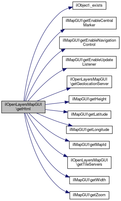
◆ getTileServers()
| ilOpenLayersMapGUI::getTileServers | ( | ) |
Get HTML.
Definition at line 49 of file class.ilOpenLayersMapGUI.php.
References $tile_server.
Referenced by getHtml().
Here is the caller graph for this function:
◆ getUserListHtml()
| ilOpenLayersMapGUI::getUserListHtml | ( | ) |
Get User List HTML (to be displayed besides the map)
Reimplemented from ilMapGUI.
Definition at line 174 of file class.ilOpenLayersMapGUI.php.
References ilObject\_exists(), and ilMapGUI\getMapId().
Here is the call graph for this function: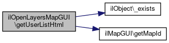
◆ setGeolocationServer()
| ilOpenLayersMapGUI::setGeolocationServer | ( | $a_geolocation | ) |
Definition at line 62 of file class.ilOpenLayersMapGUI.php.
◆ setTileServers()
| ilOpenLayersMapGUI::setTileServers | ( | $a_tile | ) |
Definition at line 53 of file class.ilOpenLayersMapGUI.php.
Field Documentation
◆ $geolocation_server
|
protected |
Definition at line 38 of file class.ilOpenLayersMapGUI.php.
Referenced by getGeolocationServer().
◆ $tile_server
|
protected |
Definition at line 37 of file class.ilOpenLayersMapGUI.php.
Referenced by getTileServers().
The documentation for this class was generated from the following file:
- Services/Maps/classes/class.ilOpenLayersMapGUI.php
